Forest Simulation and Optimization System (FSOS)
Our FSOS is a proprietary forest planning-system that is unique in its ability to link strategic, tactical, and operational planning levels. It is the most comprehensive and advanced forest-planning tool available, and it is able to maximize the ability of the forest manager to make reliable planning decisions.
The FSOS can operate in non-spatial and spatially explicit modes, with the distinct advantage of being able to model tactical harvest units and their sequencing simultaneously within long-term timber-supply projections. It considers not only traditional forest values, but it also tracks all forest stands over time and identifies the contribution of those stands to the management unit's social, economic and environmental objectives. Traditionally forest managers have wanted to know "What can we take from the forest?" In response to the need to take a comprehensive approach to forest stewardship, the FSOS goes to the next level and responds to "What can we take, leave, and create in the forest?".
The FSOS is a powerful tool that can easily be adapted to most forest-management scenarios and customized over time as new information and data become available. Designed to incorporate local operational knowledge as well as business and regulatory objectives, the FSOS allows forest managers to make reliable planning decisions when the most up to date forest, stand, and landscape information is included.
The FSOS utilizes a simple data-management structure through MS Access to manage all geographic data, forest dynamics attributes, and model parameters. Organization of spatial data is also efficient because all geographic data are incorporated into this structure in layers (as in a GIS); this facilitates the adaptation of data from a wide variety of sources. Furthermore, it is possible to hierarchically structure data from strategic to operational planning (i.e., Timber Supply Area → supply block → landscape unit → watershed → block). The FSOS can utilize forest data from any jurisdiction.
Features and Strengths
- All defined indicators are quantified over the entire planning horizon for the assessment of sustainability.
- The linkage between strategic, tactical, and operational levels is inherently hierarchical.
- It allows for the assessment of changing policy and legislation.
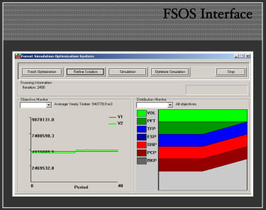
- The FSOS uses advanced modelling techniques (optimization and simulation) that can develop both short-term and long-term scenario results to meet all quantified woodlands-related objectives.
- Adaptable and continuously improved solutions are offered because the FSOS readily incorporates new information and data; changes in policies, product prices, costs and business objectives; and natural disturbances.
- Operational modifications (from Forest Development and Annual Operating Plans) can be incorporated back into the model to assess sustainability of operational reality.
- The analysis results can be presented in terms of a "trade-off" or "balanced" scenario that recognizes the myriad of objectives within a given forest landscape. If a trade-off is required the FSOS can quantify the impacts through opportunity costs and potential value losses.
- It provides results that coordinate input and communication between active interest groups (government agencies and licensees) and passive interest groups (residents and stakeholders), as well as throughout various levels of organization (executive to operations).
- All analysis results can be spatial.